
Economy
Economy
07 Nov, 2025
Tropical Storm Opong (Bualoi) Strengthens, Set to Impact Bicol and Southern Luzon
Luisito Castro
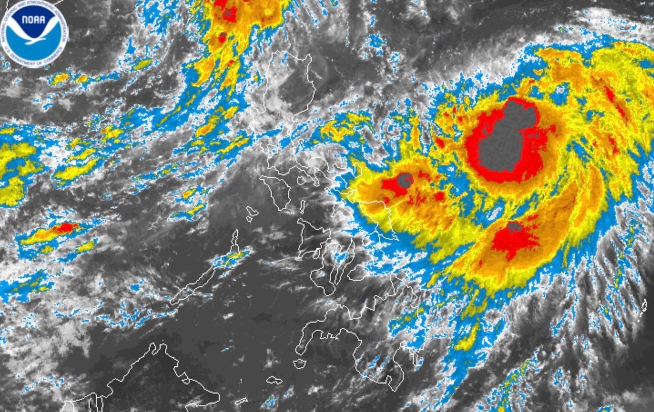
Tropical Storm Opong, internationally named Bualoi, has intensified from a tropical depression to a tropical storm over the Philippine Sea, according to the Philippine Atmospheric, Geophysical, and Astronomical Services Administration (PAGASA). As of early Wednesday, September 24, Opong exhibits maximum sustained winds of 65 kilometers per hour, with gusts up to 80 km/h, marking an increase from earlier measurements.
Opong is currently positioned approximately 855 kilometers east of northeastern Mindanao and is moving west-southwest at 20 km/h. The weather agency anticipates further strengthening of the system into a severe tropical storm by Thursday evening, September 25, with additional intensification possible.
Residents in the eastern and northern Visayas as well as areas in Bicol are expected to face moderate to torrential rainfall starting Thursday and continuing into the weekend. Specific rainfall forecasts include 50-100 millimeters in Eastern and Northern Samar on Thursday, and more than 200 millimeters in Sorsogon and Northern Samar on Friday. Metro Manila and several provinces including Quezon, Camarines Norte, and Albay are also anticipated to experience heavy rains ranging from 50 to 200 millimeters.
PAGASA has raised Tropical Cyclone Wind Signal No. 1 for northeastern Mindanao, Eastern Visayas, and Bicol starting Wednesday, providing a 36-hour preparation window. The highest wind signal due to Opong may reach Signal No. 3. Concurrently, the southwest monsoon, intensified by both Opong and Super Typhoon Nando, will trigger strong to gale-force winds in parts of Luzon, Visayas, and Mindanao over the coming days.
The weather bureau cautioned communities along coastal areas of Southern Luzon and Eastern Visayas to prepare for potential storm surges starting Wednesday or Thursday. Sea conditions are expected to worsen to moderate or rough beginning Thursday afternoon in these regions.
Opong is forecasted to make landfall in the Bicol region by Friday afternoon, September 26, and traverse Southern Luzon through Saturday morning, September 27. PAGASA emphasized that heavy rainfall, strong winds, and storm surges could impact areas outside the predicted landfall zone due to possible shifts in the storm's track within the forecast cone.
The tropical storm is expected to exit the Philippine Area of Responsibility (PAR) by late Saturday or early Sunday, September 28. Opong is the 15th tropical cyclone to enter the country in 2025 and the fifth in September, arriving just hours after the departure of Super Typhoon Nando.
Meanwhile, Super Typhoon Nando has weakened as it moves west-northwestward, located 775 kilometers west of Itbayat, Batanes, and is projected to make landfall in southern China by Wednesday evening. Despite this, the typhoon still exhibits sustained winds of 185 km/h and gusts up to 230 km/h, though weakening is expected after landfall.
Nando previously made landfall in Panuitan Island, Cagayan, at its peak strength of 215 km/h on September 22. All tropical cyclone wind signals were lifted following its exit from the PAR, but rough to moderate sea conditions persist in Luzon, particularly in the northern seaboards and parts of western Luzon.
In addition to the tropical cyclones, the southwest monsoon continues to affect Luzon and Visayas, bringing moderate to heavy rainfall in provinces such as Zambales, Bataan, Occidental Mindoro, Palawan, and parts of the Visayan islands through the weekend. Mindanao is forecasted to have generally fair weather with localized thunderstorms.
PAGASA advises residents to remain vigilant, monitor official advisories, and prepare for possible weather-related hazards as these weather systems progress.
Recommended For You

Department of Agriculture Pushes to Boost Corn Production Amid Livestock Demand
Nov 07, 2025
Roberto Navarro

Encantadia Chronicles: Sang’gre Reveals Growing Bond Between Terra and Mitena Amid Tensions
Nov 07, 2025
Emmanuel Santos

CIDG Seizes Over P600,000 Worth of Counterfeit Tire Sealant in Mandaue City Sting
Nov 07, 2025
Ricardo Fernandez

Pangasinan Provincial Hospitals Strengthen Security Measures Following Newborn Abduction
Nov 07, 2025
Jasmine Torres